
Gale force winds over 100km/h start hitting Byron coast
The latest Tropical Cyclone Alfred track map shows gale force winds are hitting the coast at Byron Bay.
The last weather observations at Cape Byron show that wind gusts of more than 100km/h are already being felt in the region, with a gust of 106km/h recorded at 9am.
A livestream on Swellnet shows that winds are occurring at an intense speed.
The cyclone is currently located 425km east of Brisbane and 390km east of the Gold Coast, according to the latest Bureau of Meteorology update.
The system is moving 11km/h as a category 2 system.
Damaging wind gusts up to 120km/h are forecast to develop along the south-east Queensland and north-eastern NSW coast – between Double Island Point and Grafton – from later today and persist into tomorrow.
Key events Show key events only Please turn on JavaScript to use this feature
PM promises quarter of a million sandbags for Queensland
Anthony Albanese has promised to urgently deliver a quarter of a million sandbags to Queensland, AAP reports, while the ADF has been placed on standby.
Heavy-lifting helicopters from the country’s firefighting fleet are also at the ready. The prime minister told ABC radio in Brisbane:
I know Queenslanders are tough but these are certainly tough times ahead in the next few days.
The prime minister touched down early today in Brisbane, with the federal disaster response plan activated and a crisis coordination team being deployed.
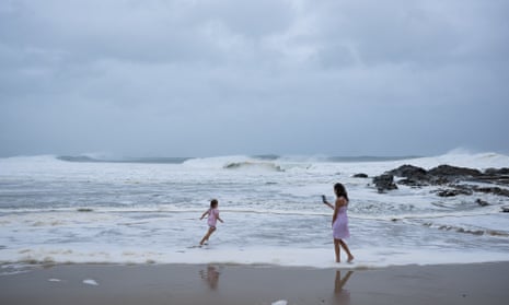
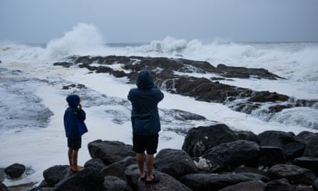
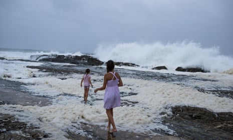
Intense waves captured at Rainbow Bay beach on Gold Coast
Here are some photos from Snapper Rocks at the southern end of Rainbow Bay on the Gold Coast, where large waves were battering the coast early this morning:
All flights in and out of Ballina cancelled today
The state MP for Lismore, Janelle Saffin, says airlines have cancelled all flights to and from Ballina today due to winds caused by the cyclone.
In a post on Facebook, she said customers had been notified and could change their flight for free “up to 7 days before and up to 14 days after their original travel date”.
According to the Ballina-Byron airport website, the following flights have been cancelled:
-
QF2063 to Sydney
-
JQ459 to Sydney
-
VA1140 to Sydney
-
JQ461 to Sydney
-
JQ465 to Melbourne
-
QF2062 from Sydney
-
JQ458 from Sydney
-
VA1139 from Sydney
-
JQ460 from Sydney
Gale force winds over 100km/h start hitting Byron coast
The latest Tropical Cyclone Alfred track map shows gale force winds are hitting the coast at Byron Bay.
The last weather observations at Cape Byron show that wind gusts of more than 100km/h are already being felt in the region, with a gust of 106km/h recorded at 9am.
A livestream on Swellnet shows that winds are occurring at an intense speed.
The cyclone is currently located 425km east of Brisbane and 390km east of the Gold Coast, according to the latest Bureau of Meteorology update.
The system is moving 11km/h as a category 2 system.
Damaging wind gusts up to 120km/h are forecast to develop along the south-east Queensland and north-eastern NSW coast – between Double Island Point and Grafton – from later today and persist into tomorrow.
Alfred rainfall made heavier ‘thanks to climate pollution’ – expert
Scientists have warned that a warmer world means fewer, but more destructive, cyclones.
In the 2024 State of the Climate report, the Bureau of Meteorology and CSIRO warn:
Fewer tropical cyclones, but with higher intensity on average, and greater impacts when they occur through higher rain rates and higher sea level.
In a statement from the Climate Council, Prof David Karoly said the extreme rainfall associated with Tropical Cyclone Alfred is “made heavier by the higher moisture content in the atmosphere, due to higher atmospheric and sea surface temperatures, thanks to climate pollution”.
The coastal storm surges, erosion and coastal flooding will be much worse due to the sea level rise in the region, which is more than 20cm since 1900 due to climate pollution.
He said Alfred developed in the wake of record-breaking hot annual sea surface temperatures for the Australian region last year, about 0.89C above the 1961–1990 average.
NSW evacuation centres to open this afternoon
Chris Minns has read out the names of the evacuation centres that will be open from 4pm this afternoon. Here is the full list, as per the SES:
-
Tyalgum Hall
-
Terranorra Public School
-
Mullumbimby RSL
-
Kingscliff Tafe
-
Murwillumbah Tafe
-
Ocean Shores Country Club
-
Coraki Pubic School
-
Kyogle Memorial Hall
-
Southern Cross University
-
Evans Head RSL
-
Burringar Sports Club
-
Uki Hall
Agencies ‘planning for the worst’ in terms of damage to homes – Minns
Asked how many homes are expected to be affected, Chris Minns said it “fluctuates” and agencies “plan for the worst”.
As far as the actual number of houses, well, many more than we would hope to see, obviously. Our planning is for something a kin to the 2022 natural disaster in Lismore, but I hope it is less than that.
As I said, right through the entire operation since Alfred emerged in the Coral Sea, we have been planning for the worst and hoping for the best.
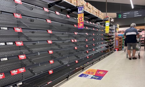
Minns cautions against panic buying
The NSW premier, Chris Minns, is now taking questions. On the potential for panic buying, he said “good logistical lines with major supermarkets” were in place.
I assure the community that we have good contingency plans in place and, regrettably, this is not the first natural disaster event that the Northern Rivers has had. As a result, both the supermarket chains, the retailers and the NSW government have got good logistical lines into those communities.
I hope people show common sense particularly for things that everybody needs and, remember, if you take more than you need in the next few days, it may be the case that you take it from a neighbour or someone else on the street.
‘Speedy recovery essential for communities’ – Reconstruction Authority
Mal Lanyon, the CEO of the NSW Reconstruction Authority, said the agency has learned from the 2022 floods in Lismore that “speedy recovery is essential for communities”.
To that end, we are preplanning for recovery … even before we go in to the response phase.
He said the agency would work with local councils to “ensure that where essential public assets such as roads need to be fixed quickly, we will work with them to get that done”.
By Thursday night, it will be too late to leave, SES commissioner warns
The SES commissioner, Mike Wassing, said the state was dealing with “three natural disaster events in one”, not seen since Tropical Cyclone Nancy in 1990.
If you live directly on the coast and you know where your high tide is, you will see water potentially half a metre above that high tide mark. Additionally, you will potentially and very likely have wind impacting your location in excess of 100km/h. If you do not feel safe in that location now is the time to relocate.
Wassing said wind of this strength would “likely bring down power lines, trees, [cause] damage and [restrict] access”.
He said it was difficult to predict rainfall but the SES is planning for “significant rainfall that will see significant inundation, isolation and potential need for evacuation.”
I want people to act now, relocate now before those circumstances are occurring. This is not just a rain event, this is a wind event, multiple wind events and then potential flash flood and flooding event.
Now is the time to act – by Thursday afternoon and into Thursday evening it is too late. By that stage we need people to bunker down and ride out the significant wind as the cyclone crosses and then we will deal with what comes on Friday.